From Prince Rupert to Prince George
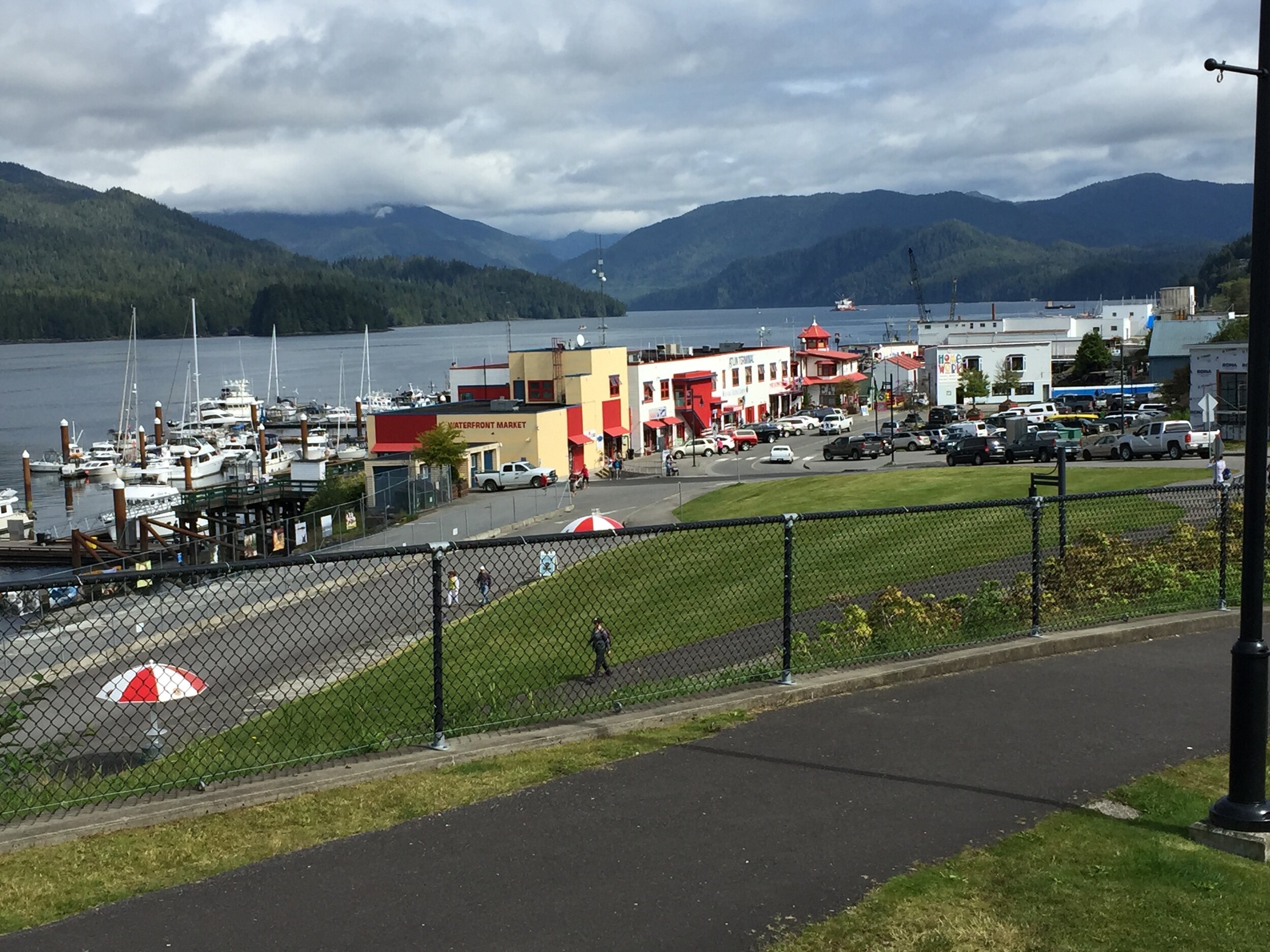 We were in Prince Rupert, a city on Canada’s far northwestern coast, that I’d always wanted to visit. Once there, it seemed like an overgrown fishing village. It helped that it was sunny outside, so we repaired to the visitor’s center by the waterfront first thing in the morning where there were lots of brochures and maps and an amazing exhibit on Prince Rupert’s virtues as a port city. Not only does it have a deep harbor, but it’s one of North America’s most secure ports and the only one with 100% dock radiation scanning. That is, it has four radiation portals scanning every container that moves through the port. Port security has become a big deal in an era where there’s great fears of terrorists sneaking in nuclear material to release “dirty bombs” in urban areas and one way to get them in is to ship it in via container, which is why there’s been a lot of news on how lax the security is at U.S. ports.The art gallery next door had a zillion local and Native artworks that I would have loved to have snapped up but alas, all we bought was a Harry Potteresque wand for Veeka, who’s been wanting one now that we’re listening to Harry Potter and the Order of the Phoenix while we drove around western Canada. Thank God for audio books. In its print version, it’s 800 pages; in audio form, it’s 23 disks and it took us the entire 11 days to listen to it all. We’d listen to it when the scenery got boring, which wasn’t often.
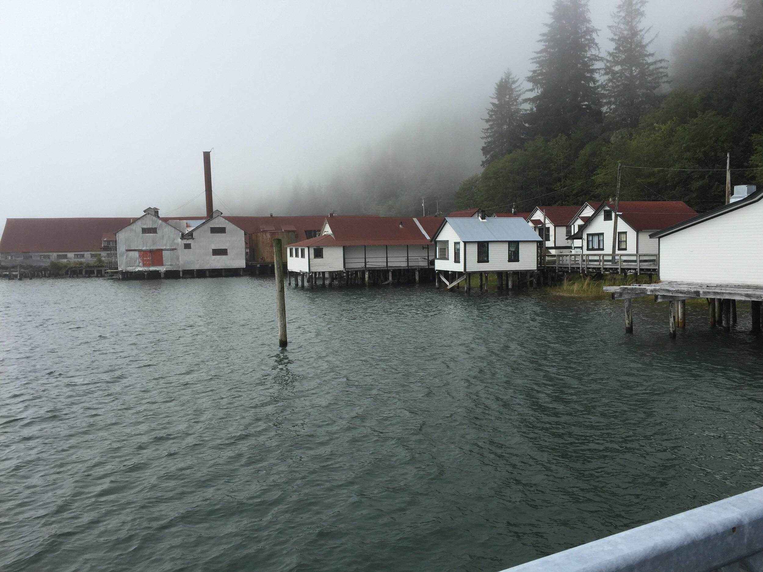 The day’s highlight was the North Pacific Cannery, the oldest intact salmon cannery on the West Coast. There used to be hundreds of commercial salmon canneries from California to Alaska. This place has a bunch of buildings on stilts in the shallow waters of the Inverness Passage where all the old canning equipment and nets are still set up. The tour – with a live guide – is well worth the $12 adult admission, as you wander up and down steps and across walkways and boardwalks where people used to work around the clock during the summer months. The place started up in 1889 and ran for 83 years, capturing salmon who were heading up the Skeena River.Our tour started with a very dated 1950s-era film showing cannery workers. It was kind of like watching an I Love Lucy skit but it did give you an idea of what life was like in this self-contained village. Never thought I’d be interested in how fishing nets were made in exact measurements so as to slip over a salmon’s head, but not its whole body, thereby trapping it. We even got to see the machines that made the lead weights for the nets. There was a swing in the net building where my daughter could swing back and forth as the rest of us walked. Veeka loved the old washing and wringing machine in the general store that was even before my time plus a little house for the company cat that was outside a manager’s door.Later, we trekked about the Butze Rapids viewpoint on the way back. That was a three-mile hike on gravel trail and boardwalk through rain forest, muskeg, beach and meadow where we saw Sitka spruce, salmon berries, fake azalea, Pacific silver fir, shore pine, yellow cedar and western red cedar and my favorite, Labrador tea. We completed it in two hours with lots of stops on the beach, where Veeka clambered about the many piles of driftwood. Another good choice and by this time, the clouds had cleared so we could see the surrounding peaks.
 On Saturday, we set out east on Highway 16 for the 90-mile drive to Terrace, which is the largest city in these parts. The gray-aqua green water, the goldenrod, the billowy clouds – clearly the local colors are grey, green, yellow plus magenta for the fireweed. It’s a 30-mile drive along the inlet, all told, and the peaks get higher and the cliffs more sheer. They say it’s one of the loveliest drives in Canada and I’d agree with that. Many fishermen were perched along the road, as the salmon were running.Terrace was at the junction of three highways and a fairly good-sized town where we located a funky coffee shop for lunch. The local tourist bureau had recommended it. Must say that in Canada, there’s these omnipresent signs with huge question marks on them which means there’s a nearby tourism office with loads of brochures and maps. There’s nothing quite like it in the United States but those were my lifeline during this trip and while driving the AlCan two years ago. They are everywhere and the government must pour money into them. Canada tourism’s web presence isn’t the best, so many times you have to literally be in the neighborhood to learn which sights to see.
 I’d been told to take a detour to the Nisga’a Lava Beds, which is the site of an enormous eruption sometime in the 1700s that buried some 2,000 people in the local Native tribe. So we headed north, the mountains getting steeper and lovelier and occasionally green lakes appearing. Only in Canada have I seen these lovely aquamarine lakes made of glacial silt. One had a hanging glacier. We could see off to our right the cone; the remains of the volcano that wrought so much destruction. We explored a few short trails to a waterfall and through the lava beds, but the edges of the rocks are quite jagged, so it’s not easy hiking.We came across a visitors center in a long narrow building at the campground. Frustratingly, the visitors center is not staffed, as I have many questions and the exhibits are sparsely worded. The place had a round door about 5 feet tall. We visited some of the local Indian villages along the Nass Valley, I wishing that we could stay the night there as the scenery was spectacular. There were some lovely suspension bridges over the local rivers and I so wanted to drive out to the coast, to see Gingolx, which recently got a paved road to its village and the route is said to be one of the most breathtaking drives in the province. It is at the head of the Portland Inlet. There was another village near that, which had a museum of aboriginal art. But we had reservations elsewhere plus it was starting to rain, so I sadly drove back to Terrace, then east on Highway 16 another two hours to Smithers, pop. 5,000. We found a great Mexican restaurant near the train tracks, so the evening wasn’t quite a loss.
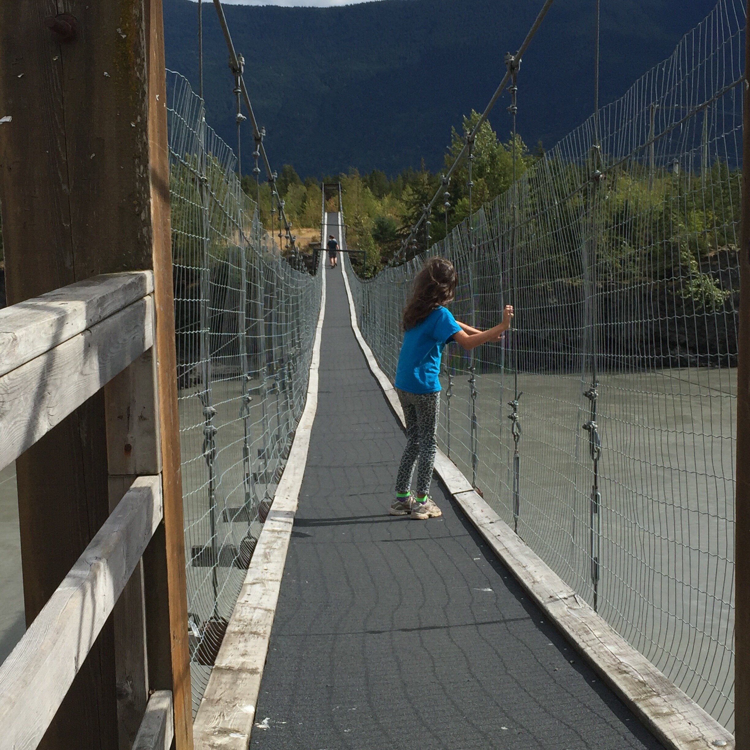 The next day was a Sunday and we learned that a lot of places close up on Sundays, even at the height of tourism seaso. It rained all day. A few miles past Smithers was Telkwa, a tiny town with a lovely red brick walk along the river with a gazebo and hanging flower baskets – perfect for a picnic had it been a lot warmer than the 60ºF on my car’s thermostat. We then drove another hour or so to Burns Lake. I’d picked up some literature at a tourism bureau about it being Canada’s “lake district” and it sure looked like England’s Lake District with lots of rolling hills and a zillion lakes where lots of folks were fishing. But it was raining the entire time and although we drove through the region a bit, the weather was enough to make us give up on seeing the area, a real loss, I thought.Back on Highway 16 and nine miles to the east was Homeside Antiques, a truly delightful barn and several other buildings full of the coolest stuff, a lot of which I remember from the 1960s plus a very engaging owner and a very friendly dog and long-haired tortoiseshell kitty who was abandoned on their property. From Burns Lake, it was about 2 hours to the Fort St. James, a historical property that was to be our hotel. The nearest large city was Prince George, but we’d stayed there two years ago and I was less than thrilled with the place back then, so I’d searched the Internet for somewhere more interesting. I found this national park, founded by fur traders, on a lake northeast of Prince George that had several historical buildings on it and where they let you stay the night. You also get dinner and breakfast. I figured I’d never again get the chance to stay in a historic Canadian fur trading post, so reserved it.
 We arrived there shortly after 5 and were served a wonderful dinner an hour later in a café overlooking a lake. I was amazed to see hummingbird feeders are outside the windows, as I didn’t know they made it this far north. One of the employees told me that winters aren’t as cold as they used to be. Instead of -60ºF, it’s -40, which I guess is an improvement. The lake doesn’t freeze as fast as it used to. Winters used to be colder and summers hotter; now it rains more during the summer and isn’t as hot.Out on Lake Stuart, all was greys and Brigadoon-like mists. Back in the houseI where we were staying, there were tons of antique clothing and furniture (ie large wooden cradles and what I think was a captain’s secretary desk) plus we had to think of things to do by flashlight, as we were pretending it was 1896 and supposed to be getting by without electricity. There was a deck of cards, but I haven’t played cards in years. There was a cribbage board, one of many I saw during our trip, but I hadn’t played that since I was a child. There was a checkers board (fortunately I remembered how to play THAT) and Crokinole – a game developed in rural Canada in the 1860s..It was a stormy night outside and our quarters had no bathrooms, so we had to sprint across the lawn to the second floor of the nearby maintenance shop. I began to understand the reason for chamber pots.
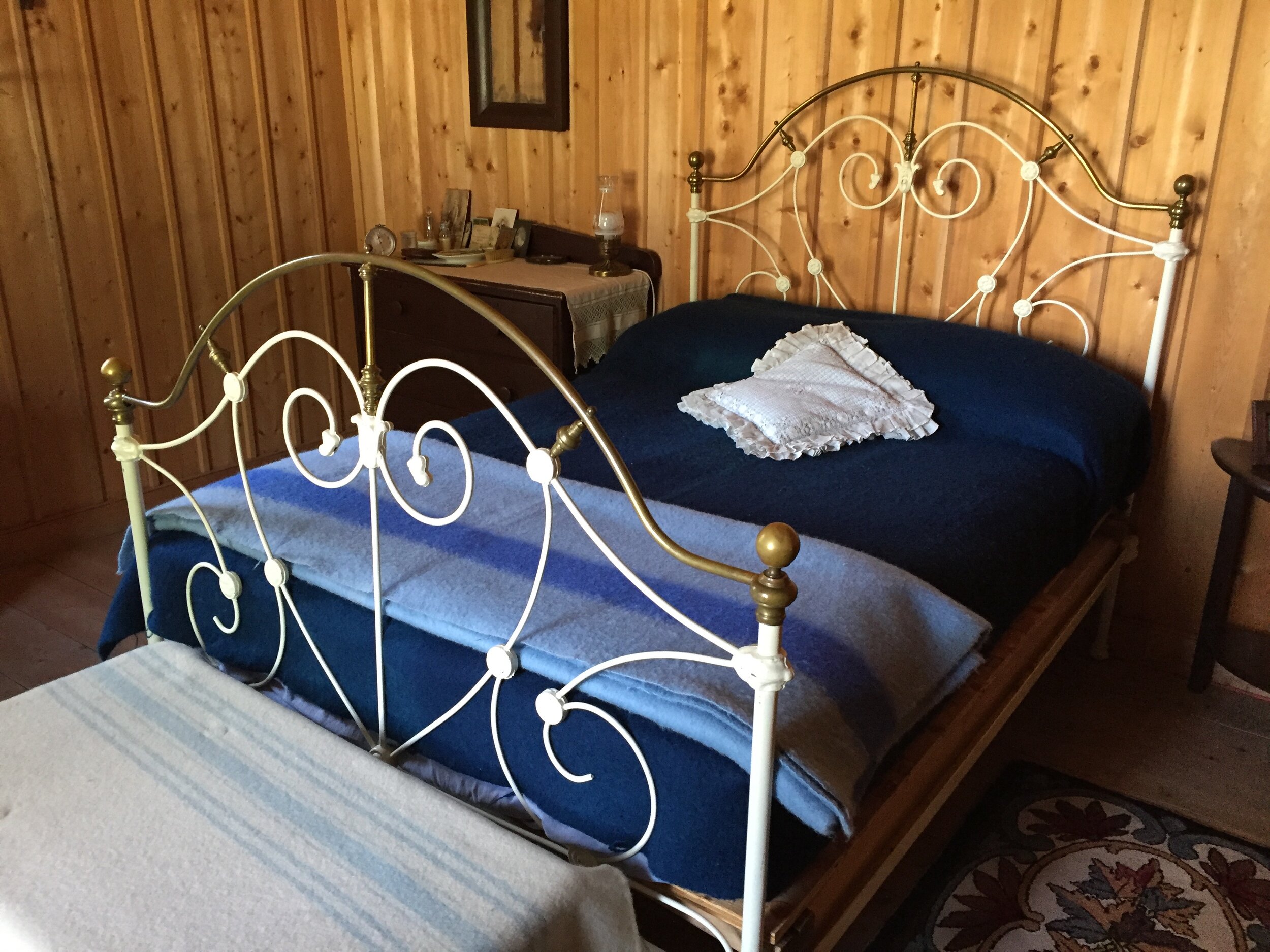 The following day, it had stopped raining and the sun was out, yet it was quite cool, with a cold wind coming in from the lake. Breakfast was pancakes with sausage in the same lovely café. We begin to wander about the buildings and learn the history of the area and how the place was founded in 1806 by Simon Fraser and it became the capital of New Caledonia, which was what British Columbia was called for the next 70 or so years. When you travel around western Canada and Alaska, you learn how vital a part the Hudson Bay Company played in the development of this whole part of the world. All of western Canada was opened up by the fur trade and explorers used a system of lakes and rivers to get everywhere. I was told one could actually canoe from Stuart Lake all the way to Vancouver by portaging over to Babine Lake, then catching the Skeena River south from there. Simon Fraser did it by using the Fraser River, although it wasn’t called that when he went on it in 1808, traveling 520 miles to Vancouver and nearly getting killed more than once in the rapids. Lewis & Clark’s expedition had been from 1804-1806, so that was really quite the decade for exploring the western half of the continent.We began wandering about the fort, stopping by a house filled with the kind of furs they trapped back then: Ermine, silver-tip fox, coyote, wolverine, lynx, otter, martin, mink, muskrat and otter, to name a few. The guide told use there are 2,800 trap lines in the area, bit there weren’t large animals in the area until 1914, when the railroad was put through from Alberta and the animals happily followed the rail lines west. I got this mental picture in my mind of bears migrating west along the railroad tracks. Veeka was given a rabbit pelt here that she had to take to a general store where she had to bargain with the storekeeper there for the kind of food they ate in the late 19th century. Employees were dressed in period costumes. The biggest fun was the daily chicken race that’s held each morning, so a crowd of us bet on which chicken would win. Ours lost both times. Outside was also huge “historic game box” with croquet, horse shoes, ropes for tug of war and a collection of sticks and be-ribboned hoops called the “game of graces;” a popular Victorian activity for girls in the 19th century, à la Jane Austen.
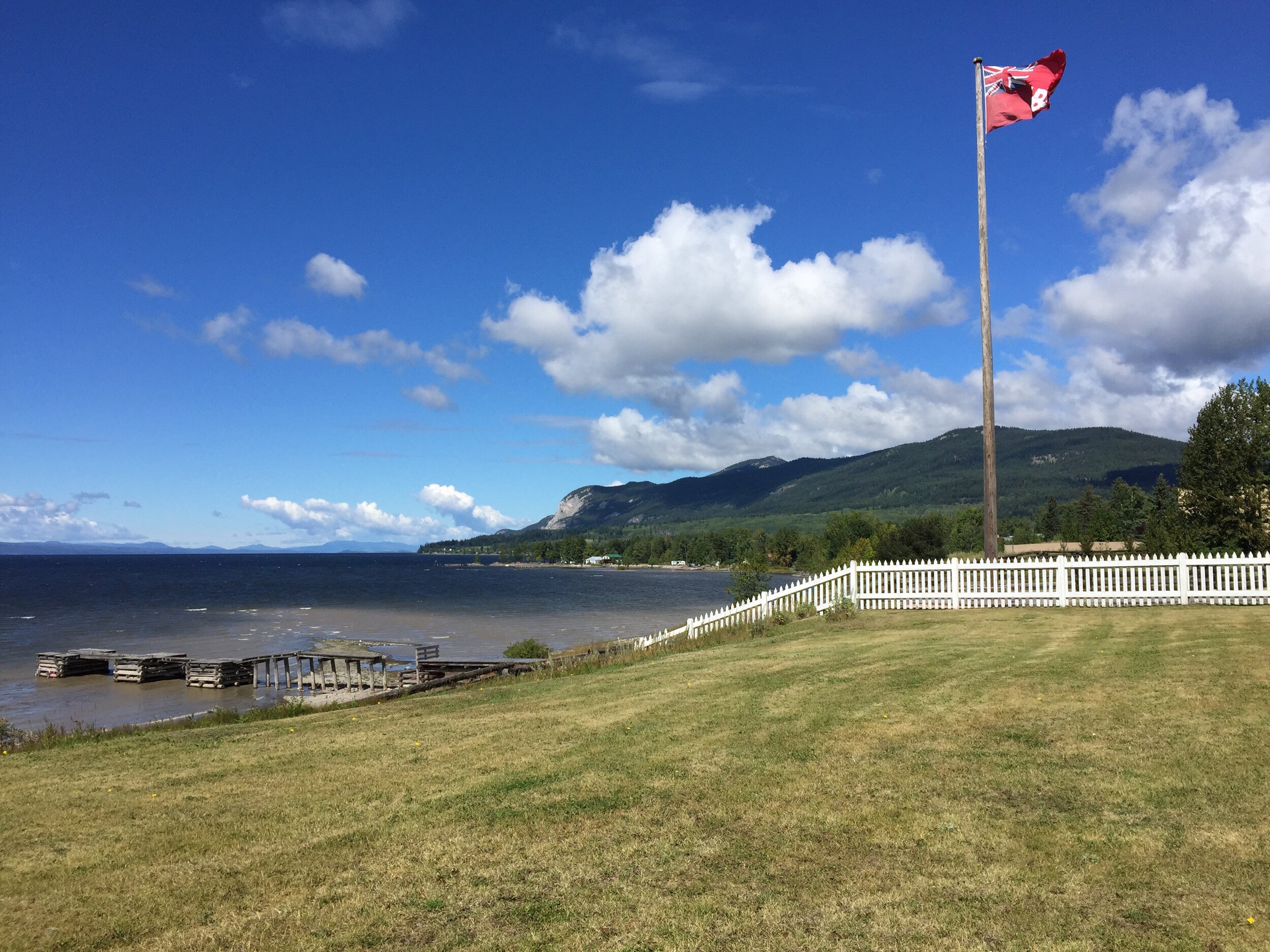 It was hard to tear ourselves away, but we had to get to Prince George (the main interior city in northern BC), then go to another historic village – this one a relic of Canada’s gold rush days – by nightfall, so off we went. I’ll finish describing our trip in the next blog.