Solstice and visiting the Arctic
It is the stroke of midnight and I can see the red blaze of a sunset behind the trees. The amount of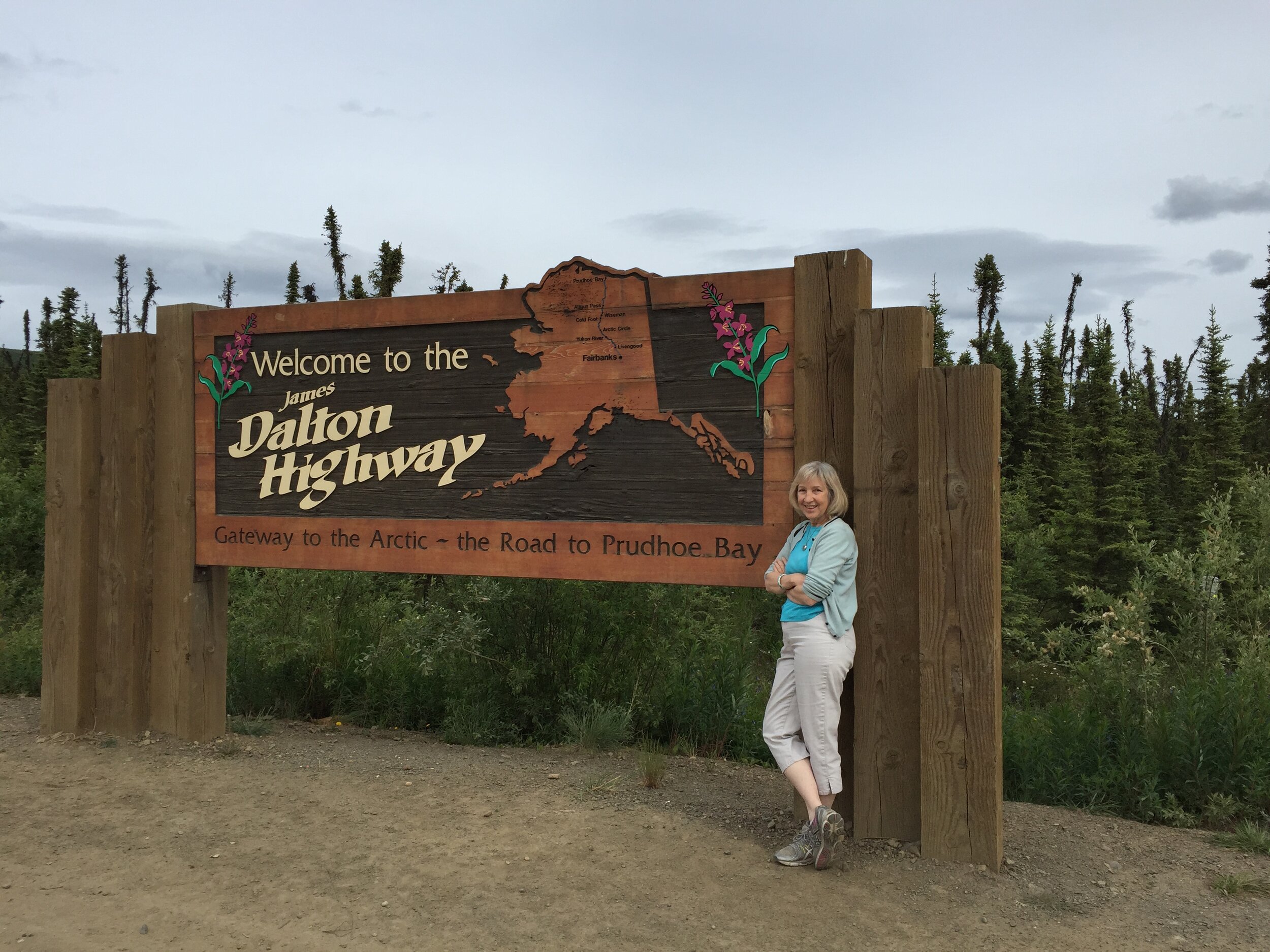 light during this magical time of year is simply amazing and it’s very hard to sleep when it looks like it’s about dinnertime outside. Yesterday we drove a 200-mile round trip down the Steese Highway to a viewpoint that many Fairbankers visit on the stroke of midnight during the Solstice (which as I write is the following day – Sunday) to see the sun linger above the horizon. It is the only point near here where one can truly see a midnight sun. Usually one has to be on the Arctic Circle to see that.Speaking of which, I got to visit the Arctic Circle – and Arctic Ocean – last week for one of the most amazing trips I’ve had since coming here last summer. I took a tour of the “haul road” used by tons of trucks to schlep equipment up to the many oil installations on the Arctic coast. First, one heads 84 miles north of Fairbanks to jump on the Dalton Highway for the next 415 miles until you get to Prudhoe Bay. Or in our case, Deadhorse, which is basically next door to Prudhoe Bay. The latter is a protected town that’s gated off because of fears of terrorism but our tour group organized a shuttle to Prudhoe Bay – more on that later.
 Although the Dalton – or the haul road as I’ll call it – is very remote and gets a bad reputation as a dangerous highway, I didn’t think it was bad at all. Then again, I was in a van with someone else driving. The huge trucks driving by are the biggest problem because of all the stones they toss through your windshield. I’d heard of the beauty of the Brooks Range, a chain of mountains in northern Alaska and knew this was my one chance to see them. The road was built in 1974 to offer a land route alongside the trans-Alaska pipeline that goes from Prudhoe Bay to Valdez on Prince William Sound. It goes along the highway here in Fairbanks so of course the locals get to see it all the time, so think it’s no big deal but seeing this huge pipeline some 20 feet above the ground does take some getting used to. One huge surprise is that 25% of the highway is paved. I’d heard it was the worse gravel road ever and that’s simply not true. It was very doable. One of the first places we stopped was the restaurant and lodge (if you can call it that) beside the Yukon River. The bridge across it is the only bridge north of Whitehorse and it’s a vast river that few in the lower 48 know about. All the lodgings along the haul road are known as “camps” because that’s what they were back in the days the road was constructed and the names have stuck. So we stopped at “Yukon River Camp” and later, “Coldfoot Camp” and “Deadhorse Camp” and so on.
 We had much fun at the Arctic Circle turnoff where we all posed for photos of us ceremoniously crossing the circle at 66º latitude. As we headed further north, the temps began to drop from the 50s to the 40s and the Brooks Range started coming into view. We were now approaching the top third of the state. Our lodgings that evening at Deadhorse Camp were surprisingly full. I didn’t think we’d seen that much traffic along the road but there were a bunch of people staying there – not that there was much choice of lodging elsewhere. Lots of truckers, of course. By this time we were within the range. The next morning, we visited this charming village called Wiseman that dated back to Gold Rush days. As this section of the world doesn’t even get sun during the dead of winter, I was trying to figure out how the early gold diggers lasted in this forbidding climate. Some 13 people live in Wiseman at present, including two B&Bs and a chapel! We were told that the Japanese flock here during winter months to watch the northern lights.
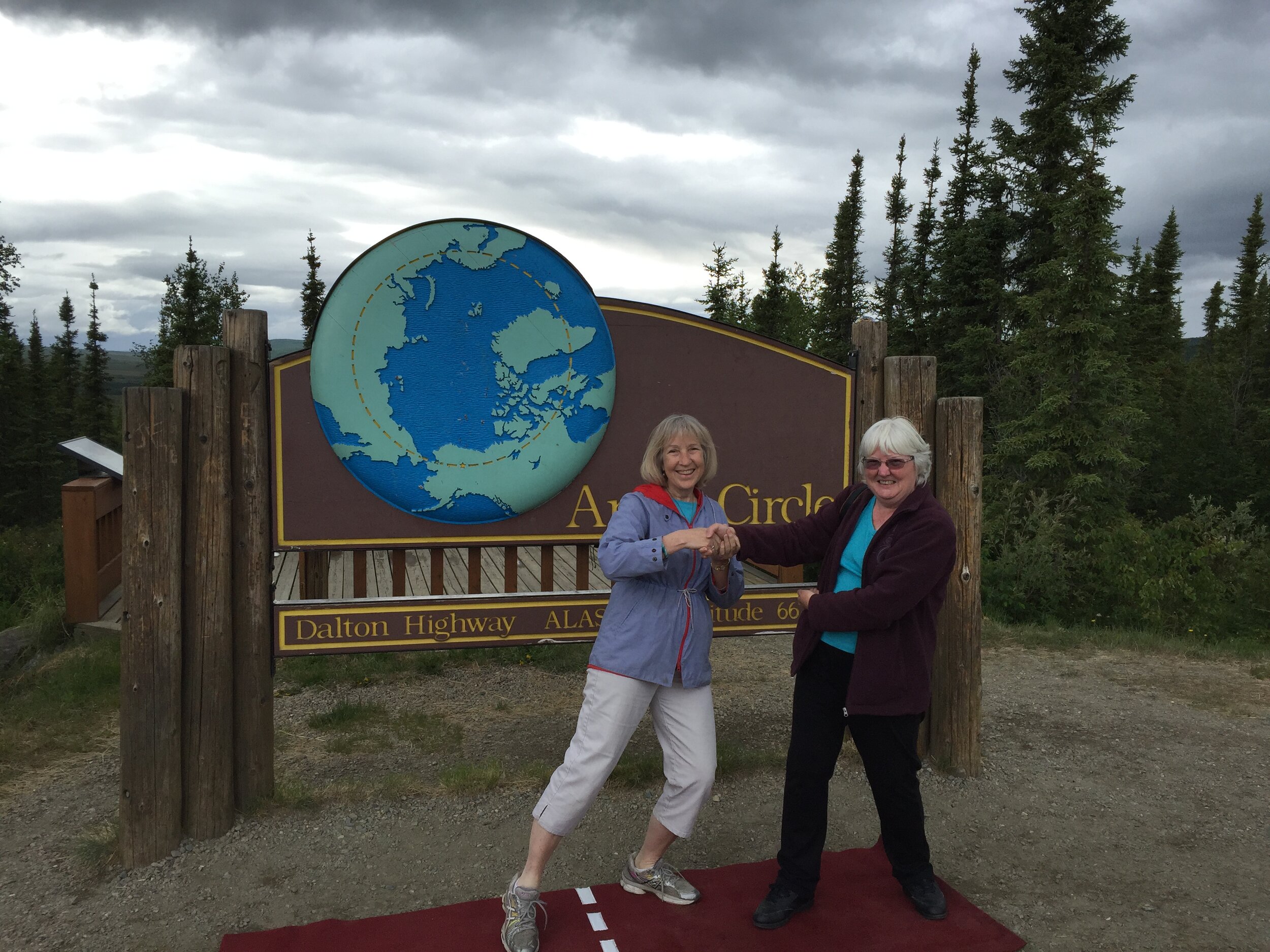 As you drive north, you pass various pump stations and camps where the original builders of the pipeline lived. And by this time the mountains had become truly gorgeous as we drove through these glaciated valleys. Then it began to lightly snow just as we climbed a rather terrifying patch of the highway that led up through Atigun Pass. To my disappointment, a lot of the mountains were fogged in at this point, else we would have seen the entire Chandalar Shelf. If I ever come back to this part of the world, I’ll try to come in late August or early September; which is a full-fledged fall here and truly spectacular with brilliant patches of pink and red fireweed, golden aspens and more. We drove by Toolik Field Station, used by UAF for Arctic research, then hunkered down for a long six-hour drive through the tundra that is the North Slope. To finally arrive in Deadhorse is to view one of the odder places on Earth: An industrial camp that has not one speck of beauty about it. Everything is oil rigs and machinery for miles around. We bedded down at Deadhorse camp and next morning took a shuttle to the Arctic
 Ocean where the ice had barely melted from the sea. Some foreigners joined up with us at this point. I was amazed during much of the trip that most of the travelers I encountered were from outside the USA. Very few people I know in Fairbanks have ever gone up the haul road as it has such a bad reputation and unless you have business up there, it’s an expensive trip and not good for one’s car. But foreigners seem to know all about the area. One of the passengers – a German – actually jumped INTO the ocean and lived to tell the tale but the rest of us refrained as it was in the 30s by this time.
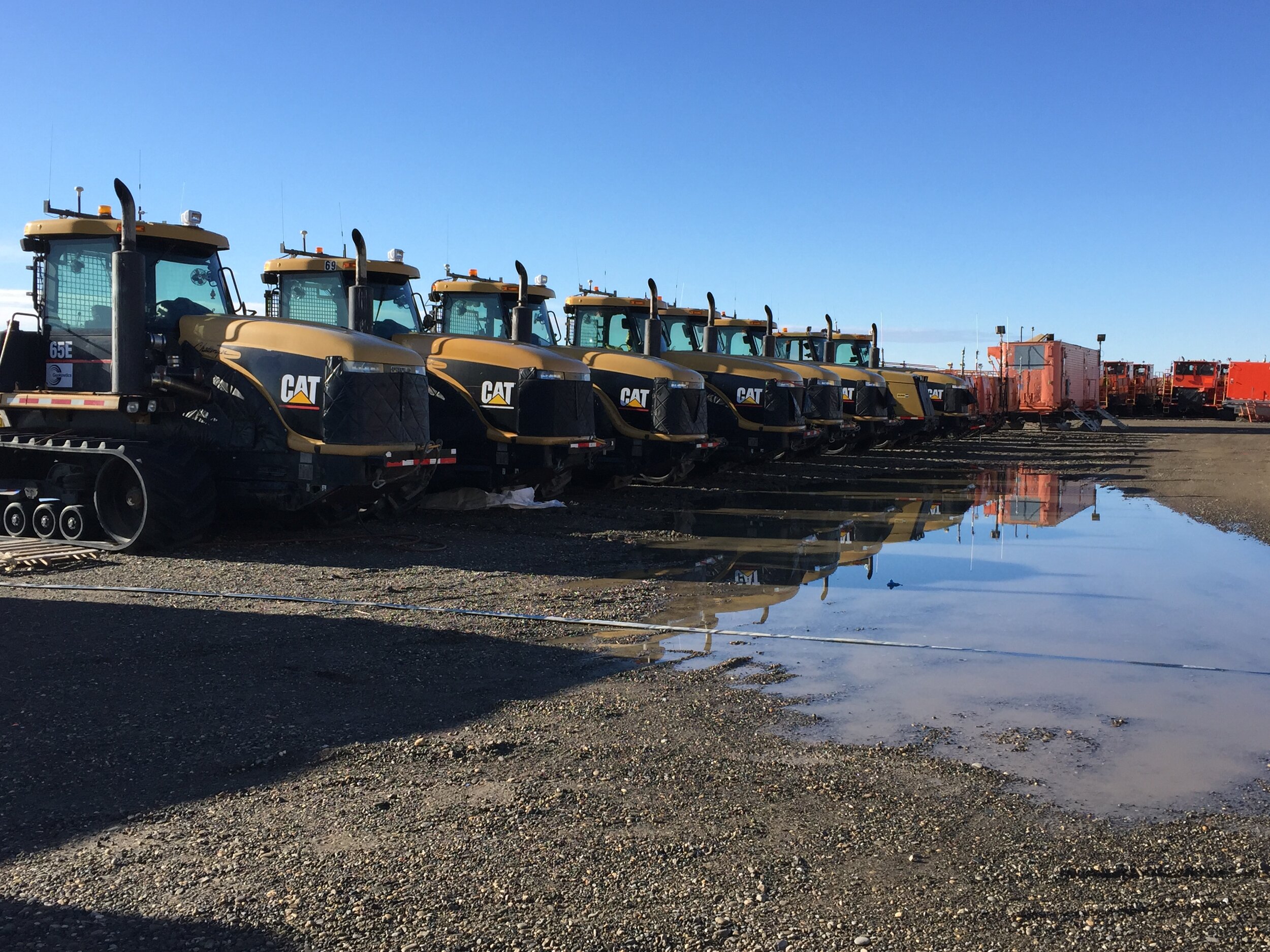 Thankfully I’d brought my ski jacket and also thankfully the sun was out in its blinding best. It had not set at all the night before which was felt very odd to have this orb shining through your blinds all “night.” The tour arranged for us to fly back to Fairbanks and two hours later, I was back home and driving to pick up Veeka from the sitter’s. I had missed little, as it had rained since I was gone.Veeka started summer school this week and it’s gone well. This weekend, we’ll be taken up with solstice celebrations that are the big thing here, understandably. On Saturday night, we will join 3,000 people on a 10K “midnight fun run.” As we only have a month left, we’ve been zooming around this area, going on hikes, driving to various gorgeous viewpoints 100 miles out of town and trying to cram it all in before we head out for good. I just gave my month’s notice for our apartment and the days seem to be going by so fast.