Seeing the Yukon, part 1
 Soon after I drove here last summer, I promised myself I’d return to the Yukon and retrace some of the places that we rushed through on our way here. Last week, we did just that: Spent 10 days wandering around western Canada. Things had quieted down around here and on May 19, I entered the last year of my 50s. Sobering thought. A friend took me out to dinner but other than that, it was a quiet day. Two days later, we started on the first of two major trips I planned. The weather was fabulous and warm nearly the entire time (compared with this week where it’s raining). Veeka/Ollie’s last day of school was May 21, so the moment her bus dropped her off, we took off for Tok, a small town on the AlCan about an hour away from the Canadian border. It was 4 hours just to get there although we stopped at various places along the way, including this cool B&B we just happened to drive by. It had HUGE mountains in back of it and the rates were much cheaper than at Caribou Cabins, the place in Tok where I had reservations. The next morning, we then set off for the border. Our route that day took us along Kluane Lake, a huge but isolated body of water along the AlCan. The temps were just below 80ºF and we were driving past the Nisling and Icefield Ranges and the Wolverine Plateau. Sounds like names out of a storybook. There weren’t a whole lot of places open for lunch, as “the season” had not started in earnest yet. We discovered this in spades when we pulled up to one visitor’s center that had closed early. Frustrated, I stood there in the parking lot and got talking with two visitors from Alberta who noticed how hungry Veeka was and offered her some Ritz crackers, which she wolfed down. Thus fortified, we hiked through a pine forest overlooking the lake to Soldier's Summit, a viewpoint commemorating where the builders of the AlCan met in November 1942 to dedicate the highway. We could smell the sage plants along the trail and we could see for miles. Truly heavenly.
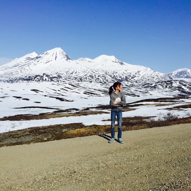 Rolling into Haines Junction, we dined (for the 2nd time actually as we’d been there last summer) at the Village Bakery, my favorite restaurant in these parts. They were just bought by new owners who are trying to expand the place and we arrived just before a music concert. But I was exhausted after 315 miles of driving, so we repaired to a B&B down the road near Kathleen Lake for the night. We had to catch a ferry the next morning and fortunately I’d arranged for the lodge owner to stash a breakfast in our fridge, as there was nowhere else to eat nearby. After gulping that down, we headed off past Dezadeash Lake (which was deserted) and then through Haines Pass, an unearthly place of more icefields and so many mountain ranges, one lost count. The deep valleys and soaring peaks looked like a set out of the movie Frozen. What was so odd is there were tons of prairie dogs running about. We felt like we were back in South Dakota! It took a lot of swerving of the car and slowing down not to hit those little beasties as they scampered across the highway right in front of us. The only downer was I only had a quarter tank of gas when we started and didn’t realize there were NO services until we crossed the US border and landed in Haines.
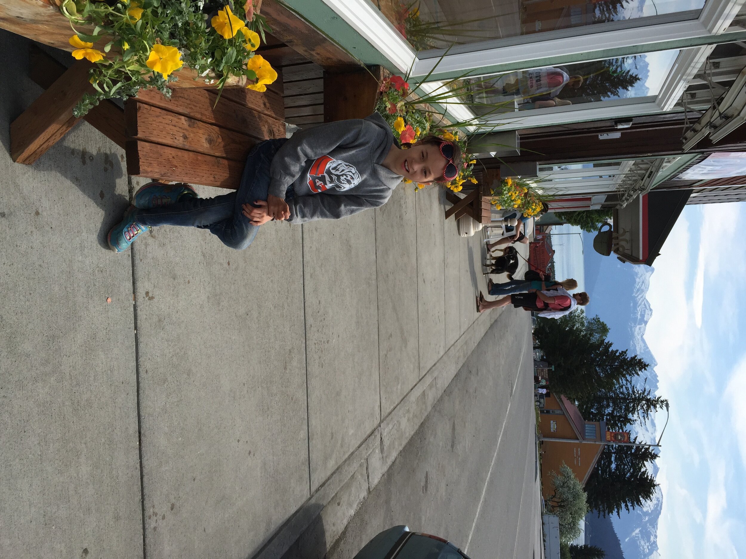 Fortunately we got there with some gas to spare. Haines is in a rainforest next to a huge bald eagle habitat. We didn’t find much to do in town other than wander about the waterfront, then hop on the 45-minute ferry up the Lynn Canal to Skagway. Note that this short ride cost me $89, whereas a similar ride on the Seattle-Bremerton ferry is $17.30! Alaska ferries are horribly expensive but they’re the only way to get from one point to another. Or maybe Washington state subsidizes its ferries? I don’t know. We put our stuff down at the White House B&B and set off for dinner with Tessa Healy and her husband Kelly. Tessa and a friend showed up the first month I had Veeka to help me care for her, so I wanted her to see my not-so-little girl at the age of 10 and more than 4 feet tall. They are part of the seasonal workforce that comes to Skagway help serve the tourists. He gives helicopter rides to nearby glaciers and she helps dispatch the ‘copters.Skagway is a former Gold Rush town that makes its money off the 4-5 cruise ships that show up in port daily. There are days when as many as 10,000 passengers are wandering about and it’s said that Skagway has more jewelry shops per capita than any other U.S. city. I was amazed at how many there were and how jacked up all the prices were compared to what I’d pay in Fairbanks. But on the rare day there is no cruise ship in port, the whole town shuts down. The Sunday we were there was like that. Hardly any restaurants were open. We hiked a lot that day in the hills above Skagway, around a ghost town called Dyea and on the rocks at Yakutania Point. That was our one cloudy day in the whole trip.
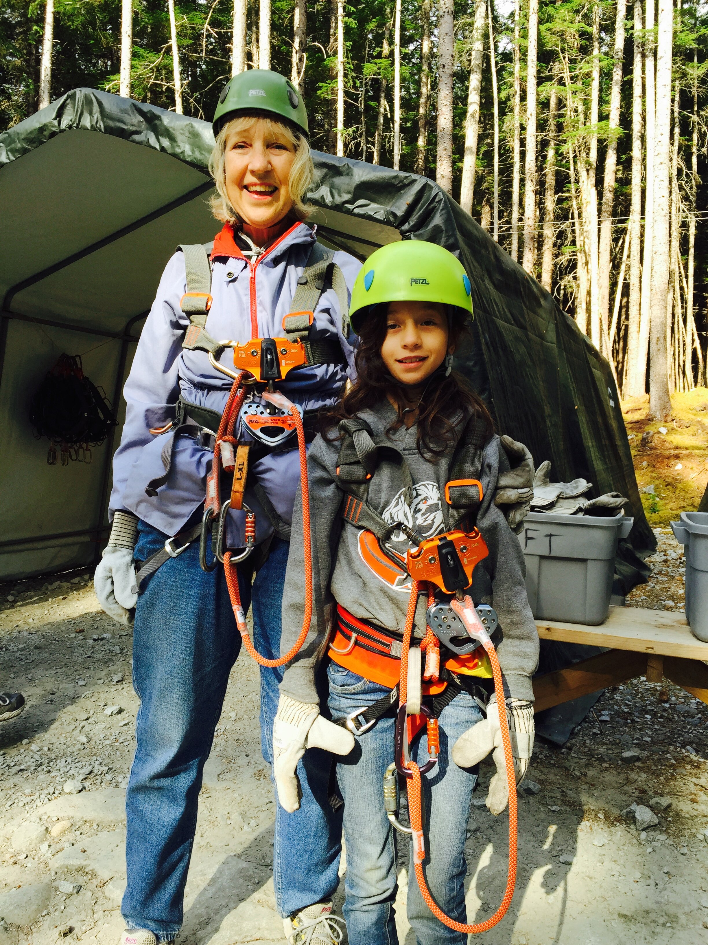 The next day, we were up early to catch the shuttle to a nearby mountain where there was a fabulous zip lines course set up. Alaska Expeditions put on a good show, I must say and we had 11 zips and four suspension bridges to cross over a raging stream (Grizzly Falls, I reckon). I had no idea how my daughter – who gets easily spooked – would react, but she was an incredible trooper. I went first during the first few zips and then she wanted to go before me. There were two zips where she was too light to go the full way, so one of the instructors went with her. I found the rides rather terrifying, to be honest. I think that, once you pass 50, something happens with your equilibrium in that I never used to be afraid of heights. I am now. I used to be able to look down at the ground with aplomb. Now, I cannot do that without feeling nauseous. I don’t know if the vertigo comes from some problem in the inner ear or what but I’m convinced there’s something biological going on.After lunch at Northern Lights Pizza (said to be the most popular eatery among the locals), we visited the Gold Rush Cemetery at the edge of town, which was a truly charming place underneath a canopy of trees with a 300-foot waterfall in the background. So many of the graves had children who died young back in the 19th and early 20th centuries, which was so much more common then. And then we drove up the White Pass back into Canada, which was almost as spectacular as the Haines Pass. The highway brought us up into Canada’s southern lakes district, which includes numerous azure bodies of water with no one on them. If this had been the US of A, there would have been tons of boats out there, as this was Memorial Day for us. But there was no one sailing and it was a spectacular day.
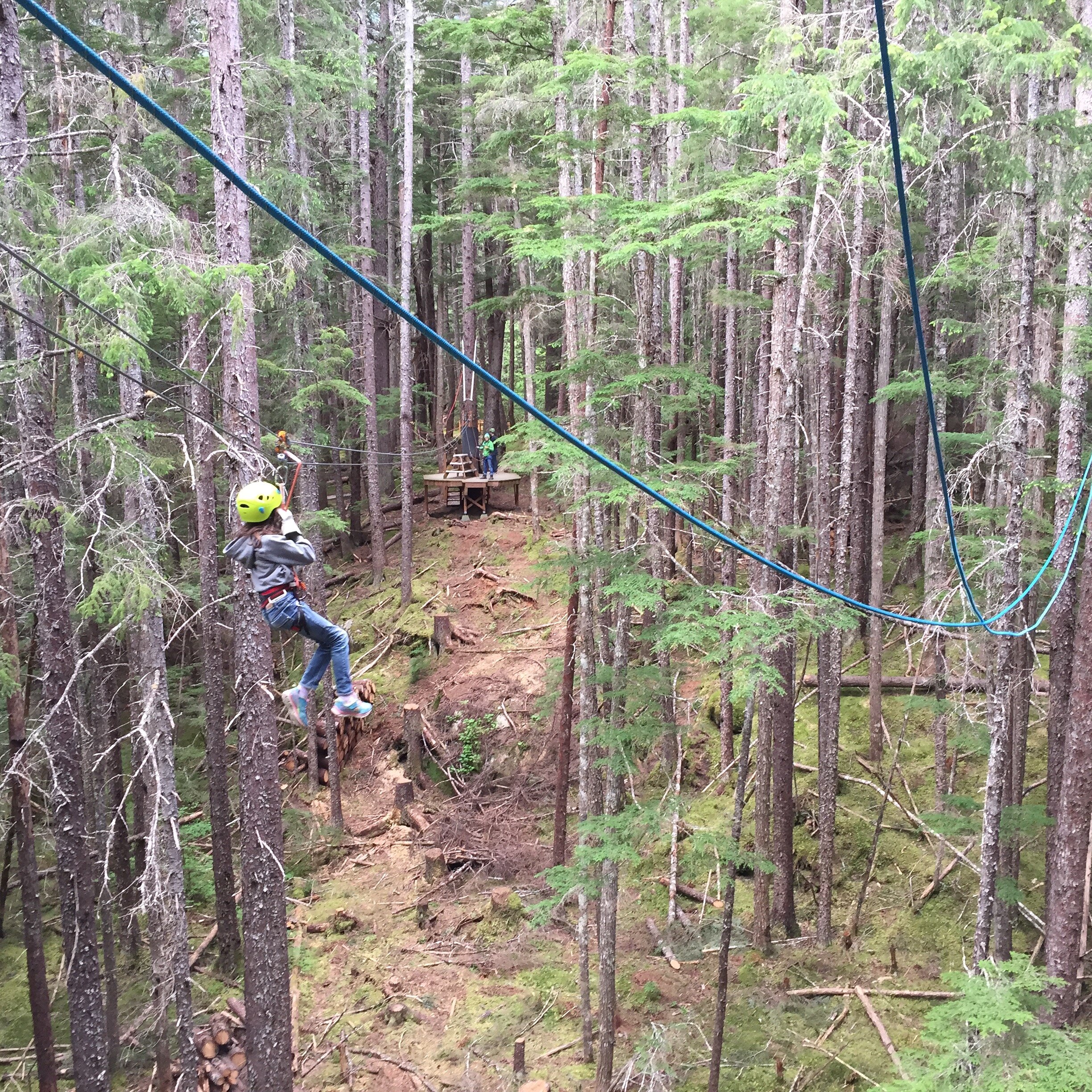 As we drove up north into Whitehorse, it amazed me how deserted the landscape was. We spent that night at a new hostel near the Takhini Hot Springs just north of Whitehorse. The next day, I drove all day through boreal forest to Dawson City, another Gold Rush town. Again it struck me as to how deserted so much of western Canada is. True, the weather is extreme here but the beauty of the place is outstanding. There are mining jobs but other than tourism, am not sure if the region is exactly booming. There’s no universities in the province and only one community college. True, only 34,000 people live there (compared to 736,132 in Alaska) but it’s become my favorite of the Canadian provinces.Part 2 of our trip to come!